
Shasha Tian
Urban Planner and Research Fellow,
Shanghai Institute of Urban Planning and Design
shashatian2@gmail.com
A Space Syntax-Based Accessibility Analysis of the Pearl River Delta
1. Research Questions & Background
Background: Rapid regional integration in the Pearl River Delta (PRD) increases the importance of transportation accessibility in shaping spatial structure.
Innovation: Extends traditional Space Syntax models to a regional multi-modal transportation network. Combines space syntax metrics, Points of Interest (POI) density, Pearson correlation analysis, and coupling coordination degree modeling.
2. Data & Methodology
Data: OpenStreetMap road/rail networks (railways, highways, national/provincial roads) and five categories of POI data (residential, financial, life services, tourism/leisure, and government institutions).
Methodology: Space Syntax Analysis (Global/Local Integration, Connectivity, Choice/Betweenness), Kernel Density Analysis, Moran’s I, Pearson Correlation Analysis, and Coupling Coordination Model.
3. Key Results
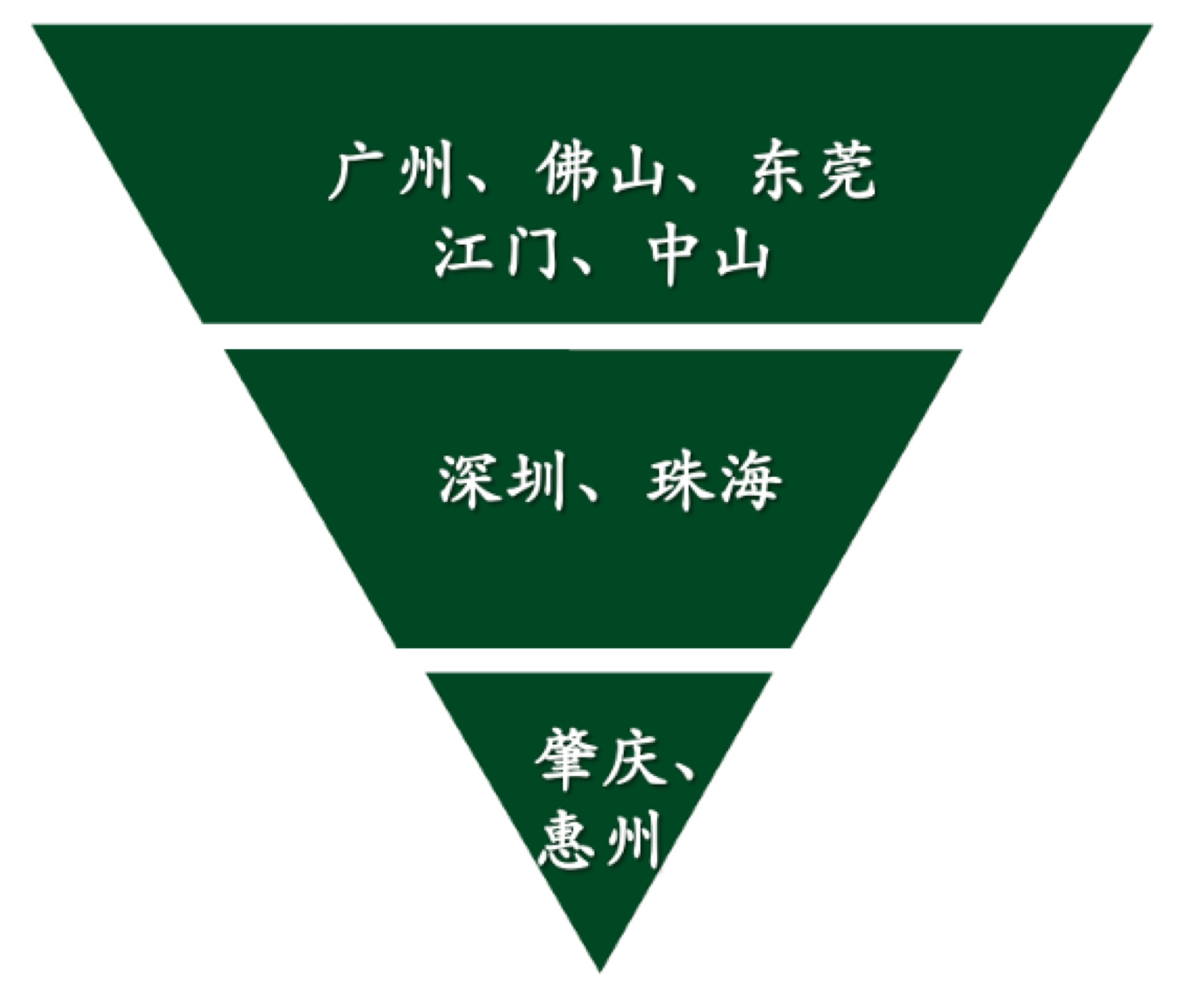
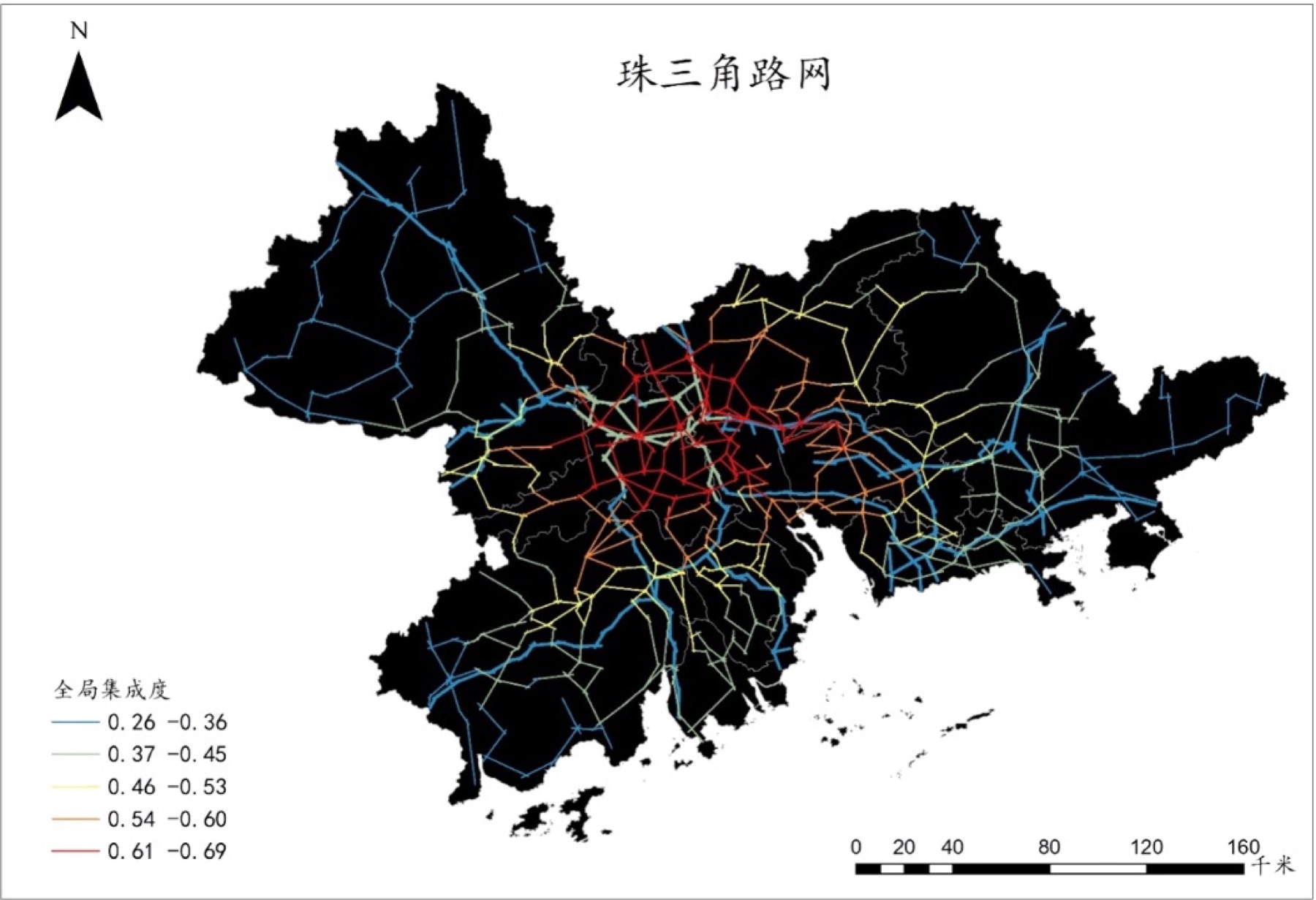
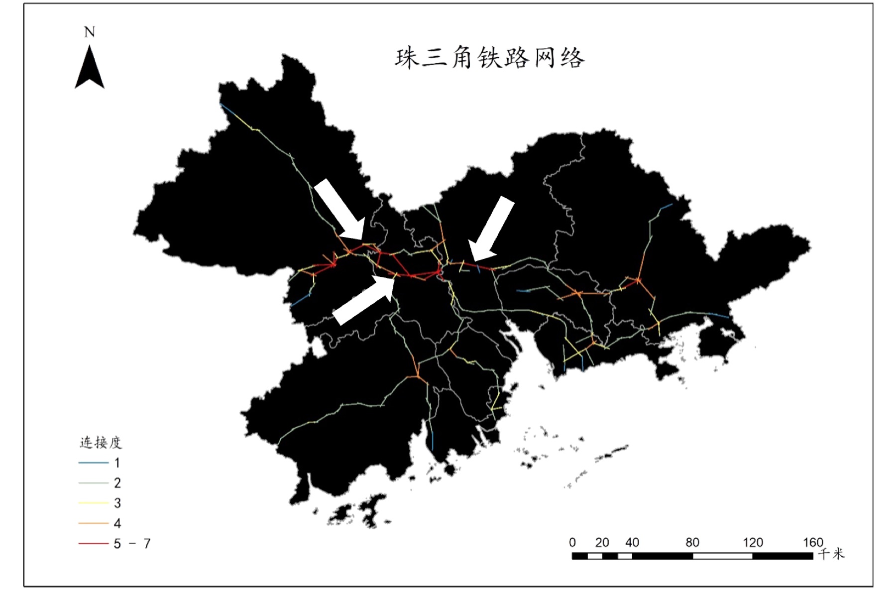
Accessibility: Transportation accessibility follows a distinct core-periphery structure across the PRD.
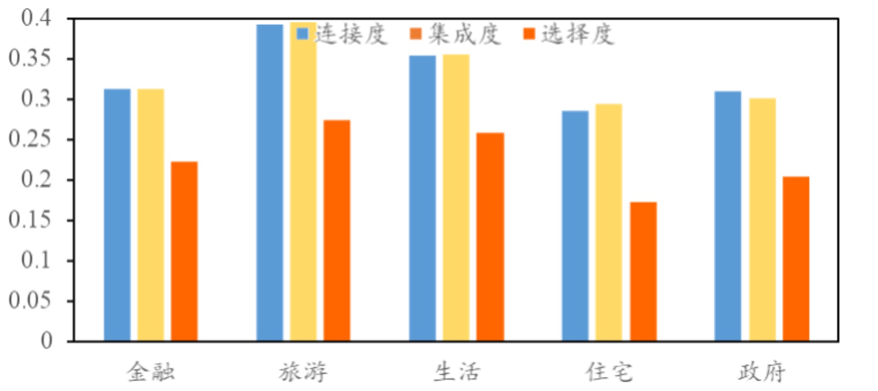
Accessibility–Land Use Relationship and Coupling Coordination:
Strongest coordination between accessibility and land-use intensity was found for tourism/leisure facilities and financial services, concentrated around core metropolitan nodes (e.g., central Guangzhou and Shenzhen).
 | Coupling Degree | High Coupling Area | Moderate-to-High Coupling Area |
| :— | :— | :— |
| Financial POI | Guangzhou City Center | Shenzhen City Center, Jiangmen City Center |
| Tourism POI | Guangzhou City Center | Shenzhen, Jiangmen, Dongguan, Zhaoqing City Center |
| Lifestyle POI | Guangzhou City Center | Shenzhen, Jiangmen, Foshan, Zhaoqing City Center |
| Government POI | Guangzhou City Center | Conghua District (Guangzhou); Enping City (Jiangmen); Shenzhen, Dongguan, Huizhou, Zhongshan, Jiangmen City Center |
| Residential POI | Guangzhou City Center | Shenzhen, Dongguan, Foshan, Zhuhai, and the vast majority of Zhongshan municipal area |
| Coupling Degree | High Coupling Area | Moderate-to-High Coupling Area |
| :— | :— | :— |
| Financial POI | Guangzhou City Center | Shenzhen City Center, Jiangmen City Center |
| Tourism POI | Guangzhou City Center | Shenzhen, Jiangmen, Dongguan, Zhaoqing City Center |
| Lifestyle POI | Guangzhou City Center | Shenzhen, Jiangmen, Foshan, Zhaoqing City Center |
| Government POI | Guangzhou City Center | Conghua District (Guangzhou); Enping City (Jiangmen); Shenzhen, Dongguan, Huizhou, Zhongshan, Jiangmen City Center |
| Residential POI | Guangzhou City Center | Shenzhen, Dongguan, Foshan, Zhuhai, and the vast majority of Zhongshan municipal area |