Shasha Tian
Urban Planner and Research Fellow,
Shanghai Institute of Urban Planning and Design
shashatian2@gmail.com
Spatiotemporal Evolution Layout and Driving Factors of Wildfires in China
1. Research Questions & Background
Objectives: Identify national-scale spatiotemporal distribution laws of wildfire occurrence in China and quantify the relative impact of natural environmental vs. socioeconomic drivers.
2. Data & Methodology
Data: GFEDv4 wildfire satellite database (2003–2016), meteorological datasets (temperature, precipitation), terrain slope data, and socioeconomic indicators (population density, GDP).
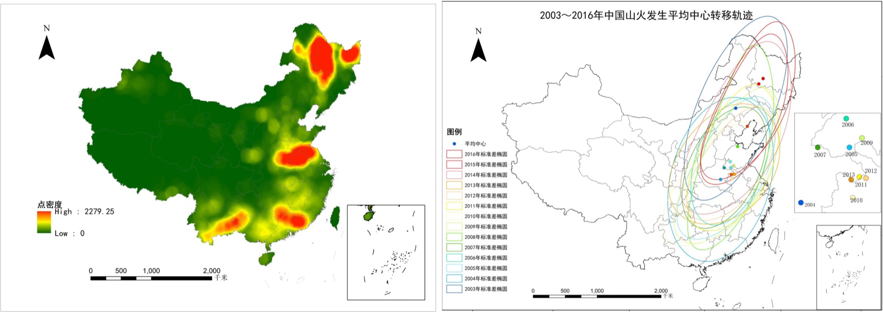
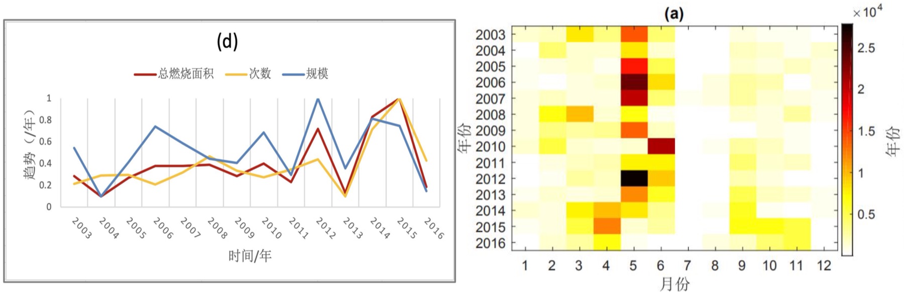
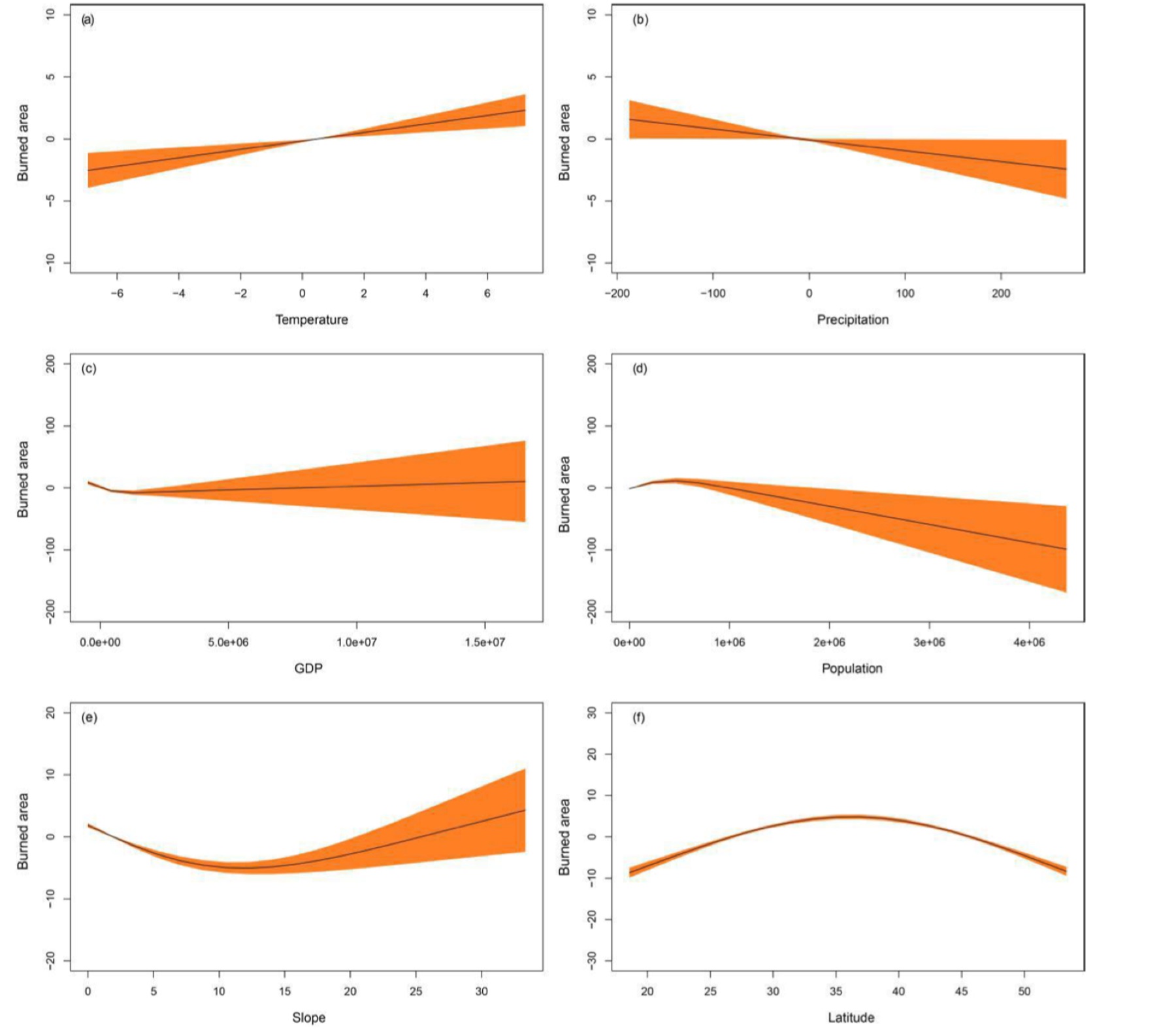
Methodology: ArcGIS spatial tools (Kernel Density Analysis, Standard Deviational Ellipse, Center-of-Gravity Migration Analysis, Linear Regression Trend Analysis) and Generalized Additive Models (GAM) to capture non-linear relationships.
3. Key Results & Personal Contribution
Findings: Revealed clear seasonal and regional clustering of wildfire occurrences. GAM modeling demonstrated that climate variables (temperature and precipitation) and terrain slope exert non-linear influences on wildfire frequency, moderated by human activity intensity (population and GDP).